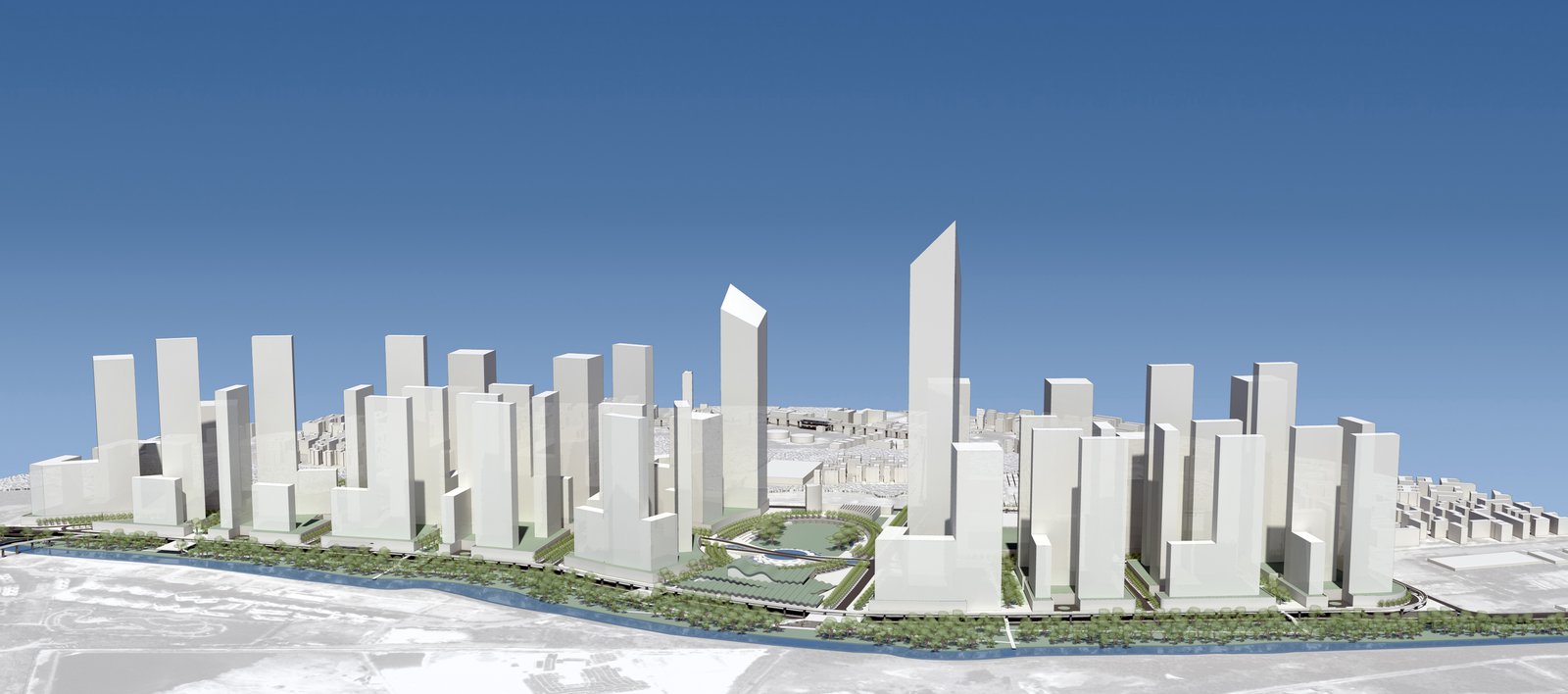
The Vision Plan focuses on the intersection of infrastructure, ecological thinking, building typologies, and placemaking to establish a framework for up to 4.5 million square meters of mixed-use development.
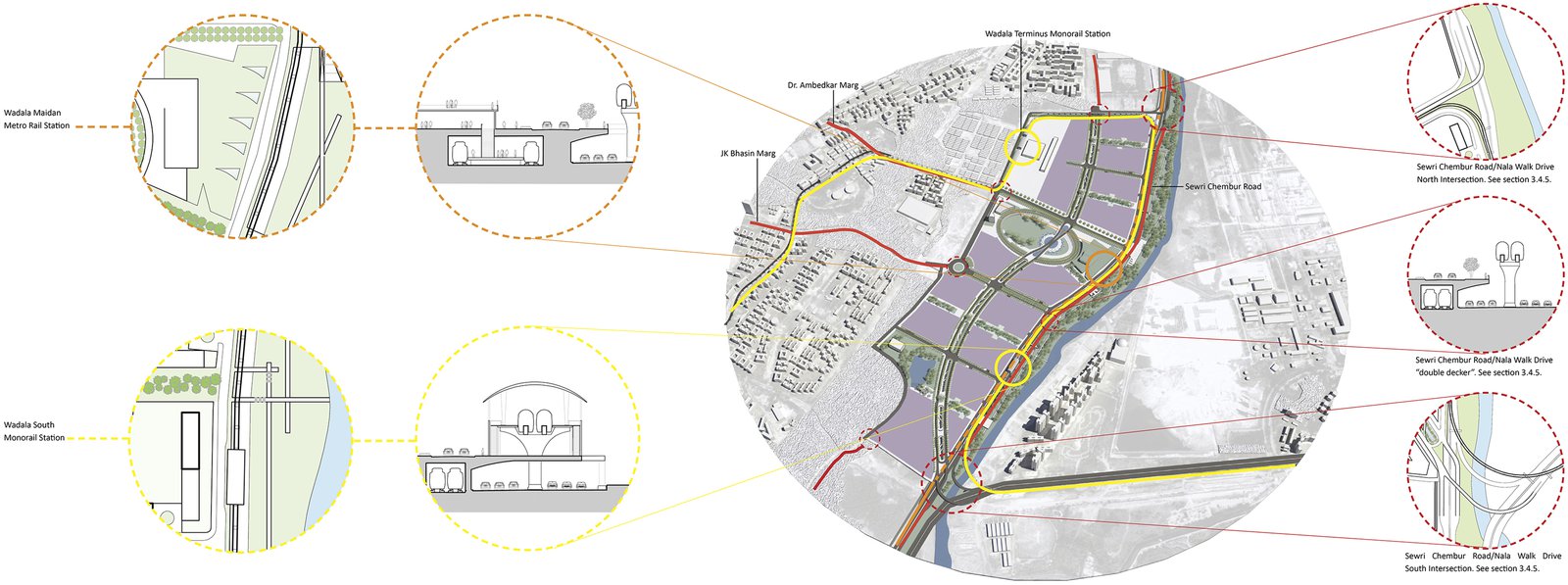
Among the many areas within the Mumbai Metropolitan Region undergoing or primed to undergo rapid transformation, the 115-hectare Wadala Study Area stands apart. Wadala’s unique attributes include its position as the center of its metropolitan region but also as a low-lying edge to Mumbai’s core. The plan describes the essential qualities of a new civic realm, offers a thoroughly integrated park and roadway system, and suggests the placement of key civic and cultural institutions.
Prone to flooding, developing Wadala responsibly means understanding its porosity and acknowledging its role in the seasonal ebb and flow of water in the island city. A key component of the Vision Plan includes the addition of simple drainage strategies, effective as conduits for storm water and vibrant places for social activity.
Show Facts
Site
A strategic parcel of former industrial land at the edge of Mumbai’s central core.
Client
Lodha Group
PCF&P Services
Master planning
lead designers
Awards
The American Architecture Award
Chicago Athenaeum, 2013
Green Good Design Award: Urban Planning / Landscape Architecture
Chicago Athenaeum / European Centre, 2012

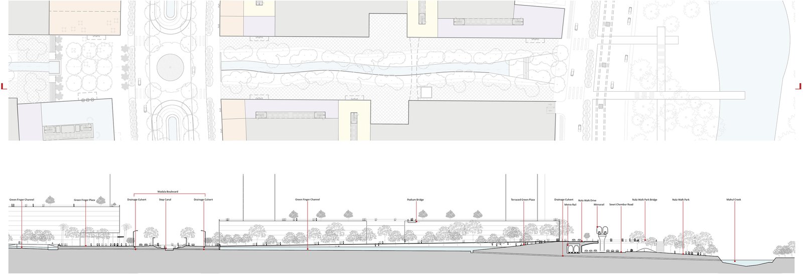
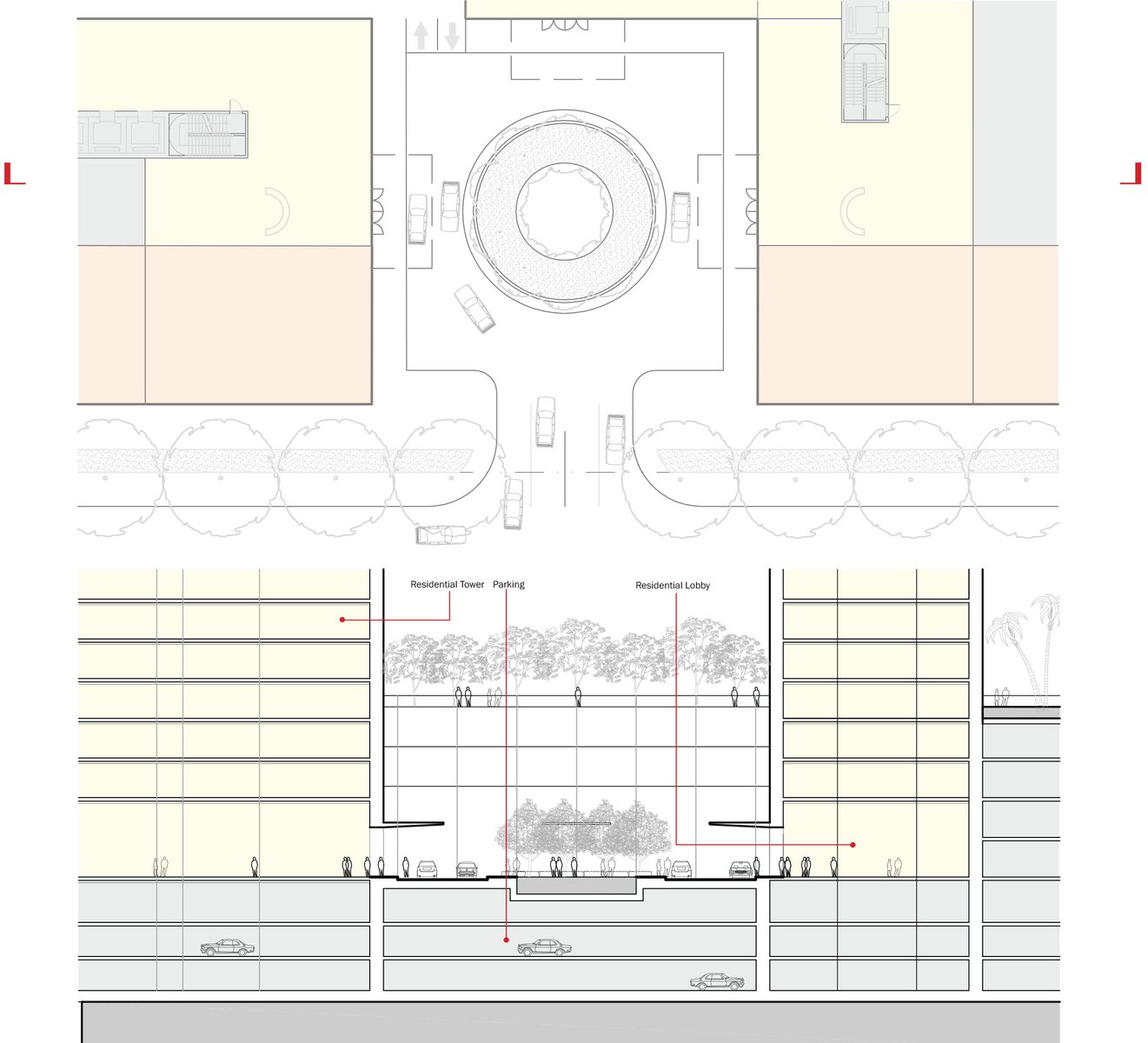
The Vision Plan, with its system of canals, channels and landscape features, is shaped by existing hydrology and seasonable flood management concerns. Traffic and transit connectivity to Mumbai and the surrounding region makes its high-density development sensible and sustainable.
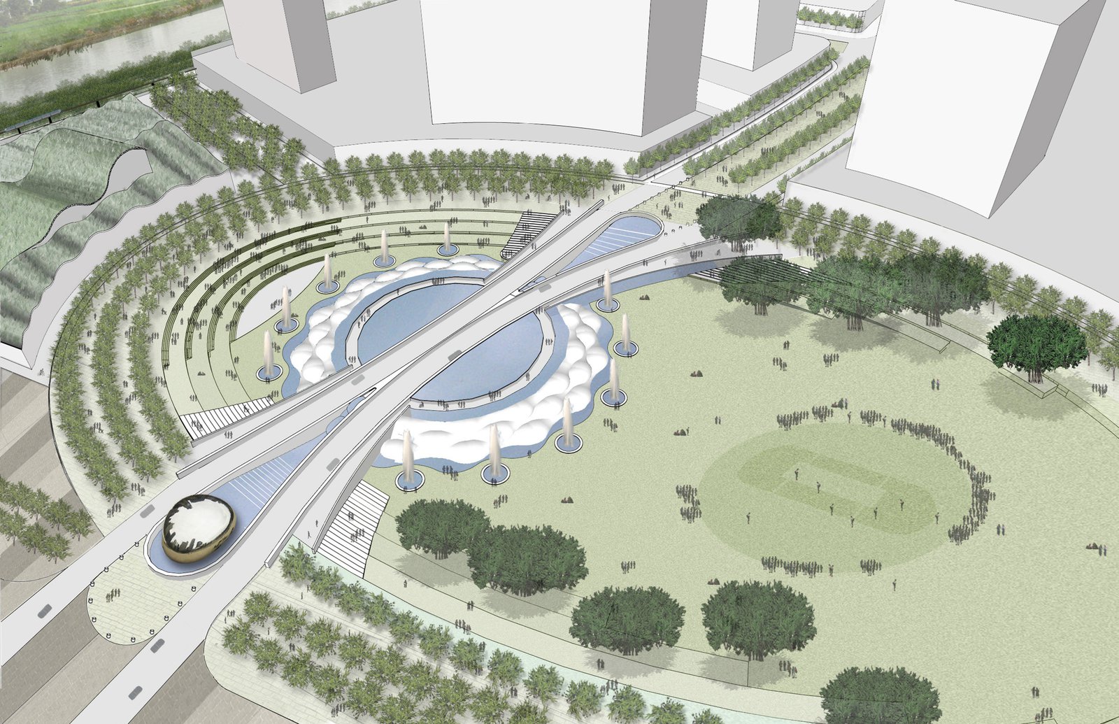
Step Canal Boulevard
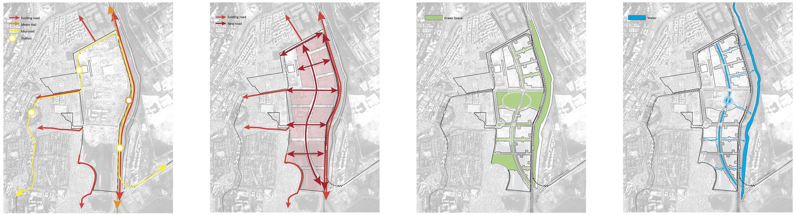
A reconfiguration of the site’s topography strategically channels excess water into a central “step canal” boulevard. Green Fingers provide additional flood resilience through their absorption, channeling, and storage of storm water.
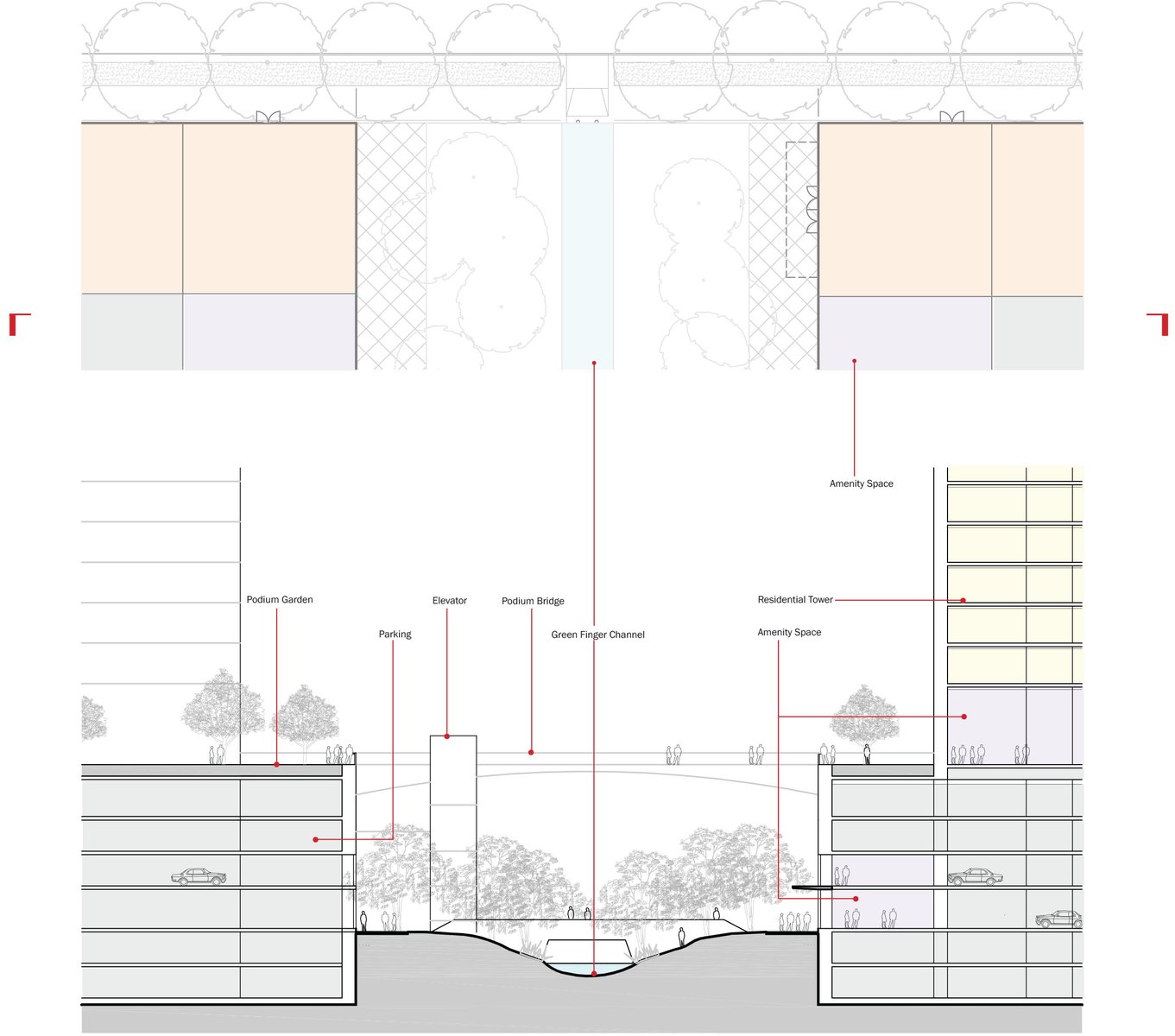
Site Section through Green Finger Channel
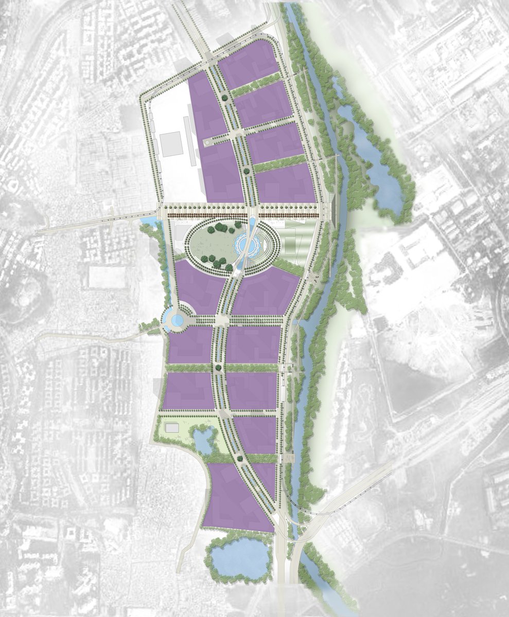
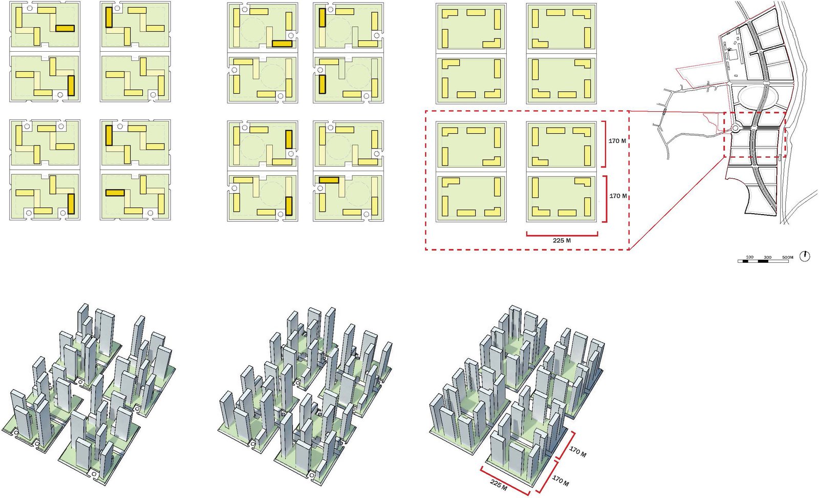
Development controls produce integrated block and building typologies that yield active commercial street life and public space at ground level, a mix of private and public space at garden level, and comfortable spacing of towers.
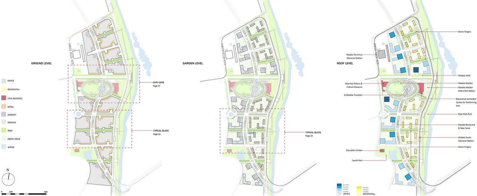
Deployed across 15 discrete development parcels, relevant block structures are placed alongside geography, connectivity, and ecology as precursors to a representative mix of uses and associated building typologies.
Project Credits
Infrastructure Planning: LEVEL Agency for Infrastructure; Landscape: Surface Design; Images: Pei Cobb Freed & Partners